Soggy, snow-capped California faces the likelihood of yet another month of wet weather, but what remains uncertain is whether this late winter precipitation will augment weeks of record-setting snowpack, or cause it to vanish should warmer rains arrive.
Last week, a frigid storm transformed portions of the state into a white landscape while toppling trees, prompting power outages, spurring water rescues and leaving some residents trapped by heavy snow.
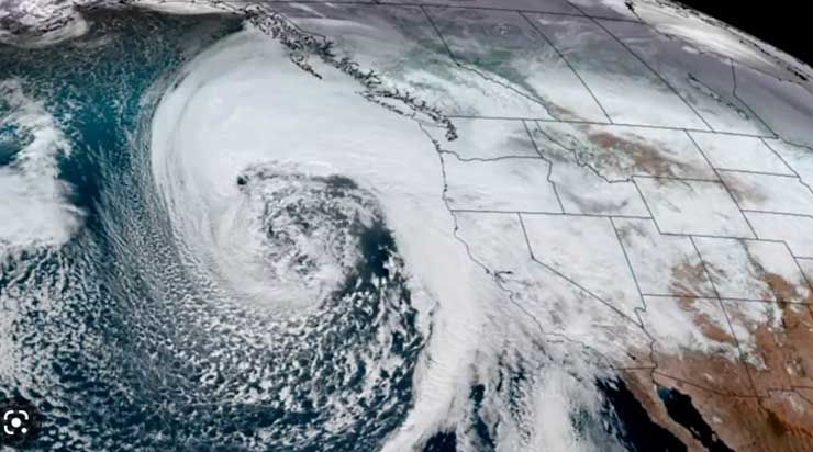
Now, with forecasts calling for more rain and snow in March – including the potential for at least one more atmospheric river system – California is girding for what comes next.
“If we were to get heavy rain with a warm system and a lot of tropical moisture feeding into it, that would melt all of the snow that just fell in the mountains,” said David Sweet, a meteorologist with the National Weather Service in Oxnard.
Typically, California’s snowpack provides about one-third of the state’s water supply and has long been relied upon for its steady, slow melting during the hot, dry months of summer. A deluge of warm rain, however, could cause melting snow to fill rivers too quickly and trigger widespread flooding.
“We need to stick that in the back of our mind and think, ‘Boy, I sure hope that doesn’t happen,’” Sweet said.
Forecasters say it’s still too early to say precisely how the rest of winter will play out, but the latest 30-day outlook from the National Oceanic and Atmospheric Administration’s Climate Prediction Center, issued Tuesday, shows above-normal chances of precipitation in all of California through March, as well as a higher likelihood of cold temperatures. That could bode well for the state’s ample snowpack.
“We have considerable confidence that wet weather is likely for the next two weeks and an active pattern [of wet weather] could very well remain for the rest of the month,” Jon Gottschalck, chief of the climate center’s operational prediction branch, said in an email.
In the coming days, the western United States is expected to be “dominated by upper-level low pressure,” Gottschalck said, which will probably deliver more low temperatures and low-elevation snow to California. That means “much of the precipitation, at least in the next week, will add to the snowpack.”
But the arrival of more precipitation in the weeks that follow could be some cause for concern.
UCLA climate scientist Daniel Swain said about 20% of forecast models are currently depicting a very strong and warm atmospheric river storm in California around mid-March. A series of nine atmospheric river storms hammered California in early January, breaching levees and contributing to nearly two dozen deaths.
Should such an event occur in the wake of extensive snow, “that could indeed pose [a] significant flood threat,” Swain said on Twitter. However, he said that is “speculation at this early juncture” because the present odds of such a warm storm are about 1 in 5.
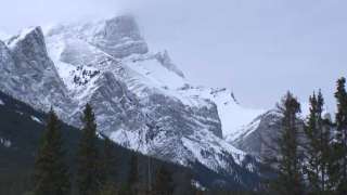
The recent winter storm already dropped heaps of cold rain and snow in parts of California. Many Southland peaks received more than 50 inches of fresh powder, with the Mountain High ski resort in Wrightwood recording 93 inches, according to the National Weather Service. Daily rainfall records were set at Los Angeles International Airport and in Burbank, downtown Los Angeles and several other parts of the region.
If similar conditions continue, the season has the chance to become one of California’s snowiest on record, Swain said.
Across the state, snowpack remains incredibly healthy — 186% of normal for the date as of Tuesday, according to state data. In the southern Sierra, it’s 224% of normal. Reservoirs are notably healthier too, with Lake Shasta nearly doubling its volume from two months ago.